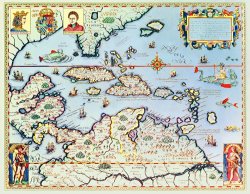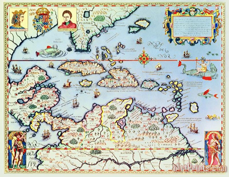
About Map of the Caribbean islands and the American state of Florida Oil Painting

Standard Oil Paintings
iArtPrints.com offers handmade Theodore de Bry Map of the Caribbean islands and the American state of Florida oil paintings at museum quality.
We believe we have some of the most talented artists inside our Studios. They are highly educated and experienced artists. We can paint any image at an affordable price. please do bear in mind that our Map of the Caribbean islands and the American state of Florida paintings are meticulously recreated by hand, brushstroke for brushstroke, so that they capture the spirit and the integrity of the original work of art.
Theodore de Bry Map of the Caribbean islands and the American state of Florida painted by artist needs 14 -18days for production and another 3 -5days for delivery.
If Theodore de Bry Map of the Caribbean islands and the American state of Florida is printed by machine on textured canvas, it takes about 5 working days to your address; if you choose it as hand painted reproduction, it takes about 18 working days to your address. Please keep in mind that all of our products are waterproof on textured canvas! We ship Map of the Caribbean islands and the American state of Florida all over the world.
Our return policy is very simple:
If you're not happy with Theodore de Bry Map of the Caribbean islands and the American state of Florida that you made on iArtPrints.com, for any reason, you can return it to us within 50 days of the order date. As soon as it arrives, we'll issue a full refund for the entire purchase price. Please note - iArtPrints.com does not reimburse the outgoing or return shipping charges unless the return is due to a defect in quality.
We sell thousands of pieces of artwork each month - all with a 100% money-back guaranteed.
If you want to purchase mueseum artwork at discount price, why not give us a try? You will save a lot more!
![Theodore de Bry Map of the Caribbean islands and the American state of Florida painting]()
Map of the Caribbean islands and the American state of Florida
![English School Map of the West Indies Florida and South America painting]()
Map of the West Indies Florida and South America
![English School Antique Map of New York painting]()
Antique Map of New York
![Italian School Antique Map of Naples painting]()
Antique Map of Naples
![American School Map depicting North America as Divided by the European Powers painting]()
Map depicting North America as Divided by the European Powers
![American School Map of the Colonies of North America at the time of the Declaration of Independence painting]()
Map of the Colonies of North America at the time of the Declaration of Independence
![Abraham Ortelius Map of North and South America painting]()
Map of North and South America
![French School Antique Map of France painting]()
Antique Map of France
![French School Map of the Island of Haiti painting]()
Map of the Island of Haiti
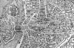
![French School Detail from a map of Paris in the reign of Henri II showing the quartier des Ecoles painting]()
Detail from a map of Paris in the reign of Henri II showing the quartier des Ecoles
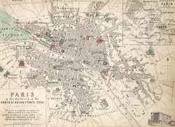
![French School Map Of Paris At The Outbreak Of The French Revolution painting]()
Map Of Paris At The Outbreak Of The French Revolution
![Cristoforo Buondelmonti A map of Constantinople in 1422 painting]()
A map of Constantinople in 1422
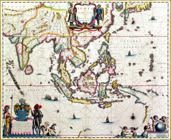
![Willem Blaeu Antique map showing Southeast Asia and The East Indies painting]()
Antique map showing Southeast Asia and The East Indies
![Jodocus Hondius Antique Map of America painting]()
Antique Map of America
![Claes Jansz Antique Map of Asia painting]()
Antique Map of Asia
![Guillaume Raynal Antique Map of Asia painting]()
Antique Map of Asia